Methods for revealing seabird migration and habitat use
One of SEAPOP’s goals is to increase our knowledge about seabird distribution and area use. Management of seabirds can be improved by identifying important key areas used both during and outside the breeding season, as well as understanding how the species cope with changes in the environment.
GPS and satellite transmitters have been very useful tools in this work. An Achilles’ heel for such technology is the battery. Its weight and size have placed many limitations on the length and detail of monitoring, as well as which species can be monitored. In recent years, solar cells and light loggers have represented new breakthroughs, making it possible to map most species, and far exceeding previous limitations.
Light loggers
A light logger is attached to a plastic ring around the foot of a bird, and can calculate the approximate position of the bird one or two times per day without requiring large battery capacity. It therefore weighs very little (<4 g), and can last for several years (from 1 to 6 years). As it is also a relatively low cost technology to use, the light logger is a favourable tool to map even the smallest of our seabirds, without burdening them with heavy loads.
The logger continuously measures light intensity in its surroundings. By identifying both length and midpoint of night and day, it can calculate respectively the longitude and latitude of where the bird is. It is important to note that the light logger has a number of limitations compared to GPS and satellite transmitters. The average margin of error is ca 180 km.
Positions cannot be calculated in the polar night, nor under constant daylight (midnight sun), and around the autumnal and spring equinoxes it is impossible to reliably calculate latitude for the positions.
Another challenge is that the logger must be collected in order to download the data. Nevertheless, light loggers have revolutionised our knowledge about seabird migration strategies and habitat use outside the breeding season.
SEATRACK is a project that maps this on a large scale, by instrumenting seabirds in many colonies in the Norwegian sea areas. This gives us new knowledge about the population fidelity, composition and size of the winter populations of our seabirds.
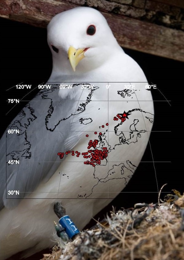
Illustration: Tycho Anker-Nilssen
GPS
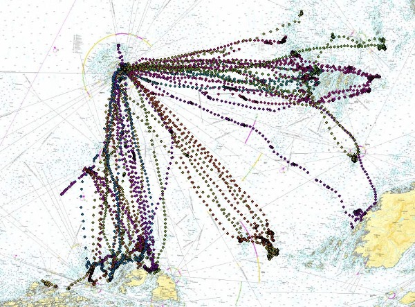
Graphics: Svein-Håkon Lorentsen
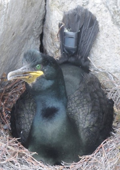
Photo: Svein-Håkon Lorentsen
A GPS is attached to the bird either as a backpack or with tape to the tail or back feathers, and there are many different types of devices. GPSs have high precision (ca. 5 m). This makes them very practical to use in the breeding season when we can map the area use of the birds when they are away from the colonies with great precision. This is important because the seabirds are vulnerable to local changes in the habitat.
A downside to GPSs is that a fair amount of energy is required to run the device, and to a large extent one must balance the weight of the GPS against the desired battery lifetime. Besides, there are many birds that are not suited to these kinds of devices because of their size or behaviour. Normally, a GPS only lasts a few days with batteries that are relatively light. Traditional GPSs also require recapture to download the data, but devices that can send data to base stations have now been developed. GPSs with solar cells that charge the batteries are also on the market. These are considerably lighter (down to 5 g) and last longer if the light conditions are good. Compared to light loggers, GPSs are considerably more expensive.
Satellite transmitters
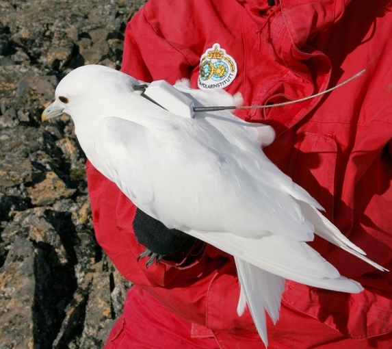
Photo: Hallvard Strøm
Satellite transmitters are based on the Argos network of satellites and have traditionally calculated a bird’s position with the help of the Doppler effect. This can give positions with an accuracy between 1 km and 150 m. Some new models also have built-in GPS, and these give just as good positions as GPS loggers do (ca. 5 m). Satellite transmitters can therefore give detailed mapping of the area use by individual seabirds over long time periods outside the breeding season, without having to recapture them. They are often attached to the back of the bird with a backpack, and transmit its position every few days.
Solar cells have made it possible to reduce the weight of the satellite transmitters drastically, while at the same time transmitting positions far more often when light conditions allow. The cost, size and weight all limit the use of this type of logger, which is an advantageous logger to use when fairly precise positions are desired, or when light conditions are not good enough for the use of light loggers.
Satellite transmitters are used in for example studies of the migration pattern of the ivory gull (Pagophila eburnea), a species with an extreme northern distribution and which lives under the midnight sun and polar night for large parts of the year.