Methods for mapping along the coast
Seabirds along the coast are mapped from three different platforms: From airplane/helicopter, boat, and from land. In addition, an array of different counting methods is used, including sampling sites, area calculations, transects, random point counts and stratified sampling. We have counted from pictures, with binoculars, and we have walked a lot. And not least, we have seen a lot!
See maps and data on seabird distribution
Counts from boat and from land
One aspect is the platform. A more important aspect is the methods that are used. They span from total counts, where all individuals, pairs, nests or nest openings are counted, to random point counts, where only a selection of areas or sampling plots are counted, and numbers for larger areas are extrapolated from the data of these points.
Total counts of breeding populations are in some areas conducted from boat and by landing in all colonies, or a selection of the colonies. The same areas are also preferably counted from the air to verify the different methods against each other.
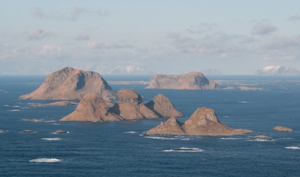
Photo: Geir Helge Systad
Counts from the air
In order to span our elongated coastline, some of the counts must be done from airplane or helicopter. Some species are difficult to count from the air, especially in the breeding season when many species nest hidden. These are either excluded from calculations, or attempts are made to include them by counts made from boat or from land. Air counts cover larger sections of the coastline, and are used in all seasons. Moulting data is primarily covered by SEAPOP with the help of counts from airplane and helicopter.
Counts from airplane and helicopter are either conducted as total counts, where all birds detected are counted, or by transect method, where we count along several transects that are later aggregated according to the area the transects are meant to cover. This methodology has been used by the Danske Miljøundersøkelser (DMU) during winter counts south of Røst.
When conducting counts from airplane and helicopter, the goal is to count all birds in an area. Of course, there are a number of birds that are not seen from the air, since they dive or disappear when the airplane is in the area. However, all in all, this method works well. Individuals and smaller flocks are counted from the airplane, while larger flocks are photographed and counted later. Geographic positions are continuously registered, and the data is either inputted directly into a field computer or read into a dictaphone.
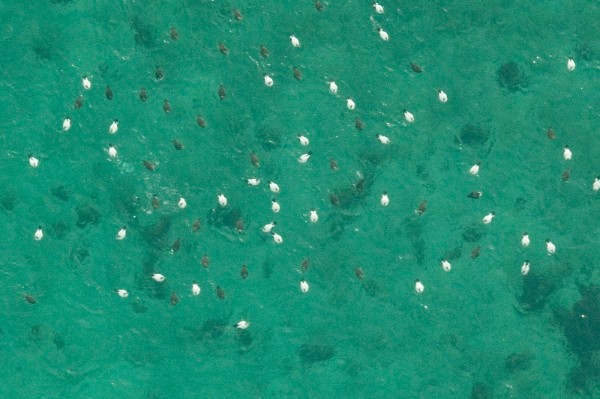
Photo: Norwegian Institute for Nature Research