New web page with map application for SEATRACK
Thanks to light loggers – a small tracking device attached to the bird’s leg – we now have a wider and more overall picture on where the seabirds actually spend their time between breeding seasons. SEATRACK is, as of now, the world’s largest single initiative for tracking seabirds using such loggers, and the results from more than 2000 loggers collected so far are now available.
Data available through new web application
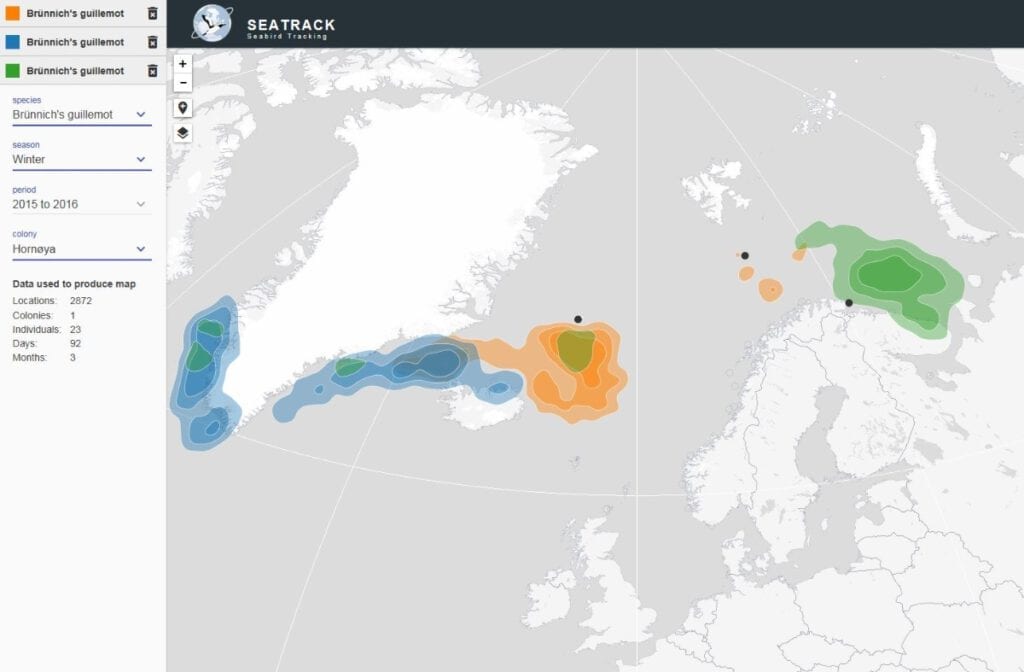
The whereabouts of seabirds from SEATRACK are now available on dedicated pages within the SEAPOP web site, where you can also read about light loggers, the aim and organization of the project, and the species and locations we are working on. Clicking further into the SEATRACKs map application, you can easily choose the species, colonies, seasons and years you would like to view position data on. You can make several such filtered selections in the same map, and compare the areas used by the different populations at any given time. Data from older studies of this kind are also available in the map application, and with time, more data will be added. Although we wish to present the results to the public, it will not be possible to download the maps. If you wish to utilize data from SEATRACK, you must contact the SEATRACK project.
Large scale mapping and monitoring
SEATRACK started in 2014 as a module of SEAPOP. Since then, the project, with partners from the Faroes, Iceland, Norway, Russia and Great Britain, has instrumented 11 seabird species with light loggers on more than 38 locations around the North-Atlantic Ocean and the Barents Sea. Even though the position data from a light logger cannot match those of satellite or GPS units in terms of accuracy, light loggers are cheaper, very lightweight, and have a longer life span. For large scale mapping and monitoring of seabird movements in space and time, light loggers represent a “quantum leap” for research and management. Within the first three years of the project, close to 7000 loggers have been deployed on birds, and approximately 2000 of them have been recovered for data download and analysis. The project is scheduled to run until 2018, and its main objective is to enhance our knowledge about migration routes and wintering areas for seabirds breeding in relation to the Barents Sea, the Norwegian Sea and the North Sea.
Relevant links:
- SEATRACK on Norwegian Broadcasting Corporation web site, May 25th, 2017 (in Norwegian)
- Norwegian television news item on seabirds and oil drilling in the Barents Sea, May 25th, 2017 (in Norwegian, starts 14:15 into the recording)
Contact person: Hallvard Strøm, Norwegian Polar Institute

