SEAPOP’s work on GPS tracking is presented on new web page
Using small GPS loggers, SEAPOP has been mapping seabird movements near breeding colonies at several key sites for some years. A dedicated page on SEAPOP’s home page now gives an overview of the work and presents a few examples of the results.
Detailed information on important feeding areas.
Seabirds depend on access to ample food to provide enough nutrition for themselves and their chicks during the breeding season. What they eat and where they find the best food items depends on the species and breeding area. To get a detailed picture on what type of areas they choose to seek out for food, we instrument them with small GPS loggers. This work takes place on SEAPOP’s key sites and has been going on for some years. To display which colonies and species we work with, we present an overview on a dedicated page that you can enter directly by clicking the “GPS tracking” button on our home page.
The page is under development
In our overview you can see some results from the GPS tracking presented as maps with kernel densities, which are calculated based on the number of point-registrations of individual birds per area. In this way, the maps show how frequently different areas are visited, and which are important in their search for food. So far, only a few maps have been prepared, but the plan is to make more maps available continuously, so that the page improves, and the information becomes more comprehensive.
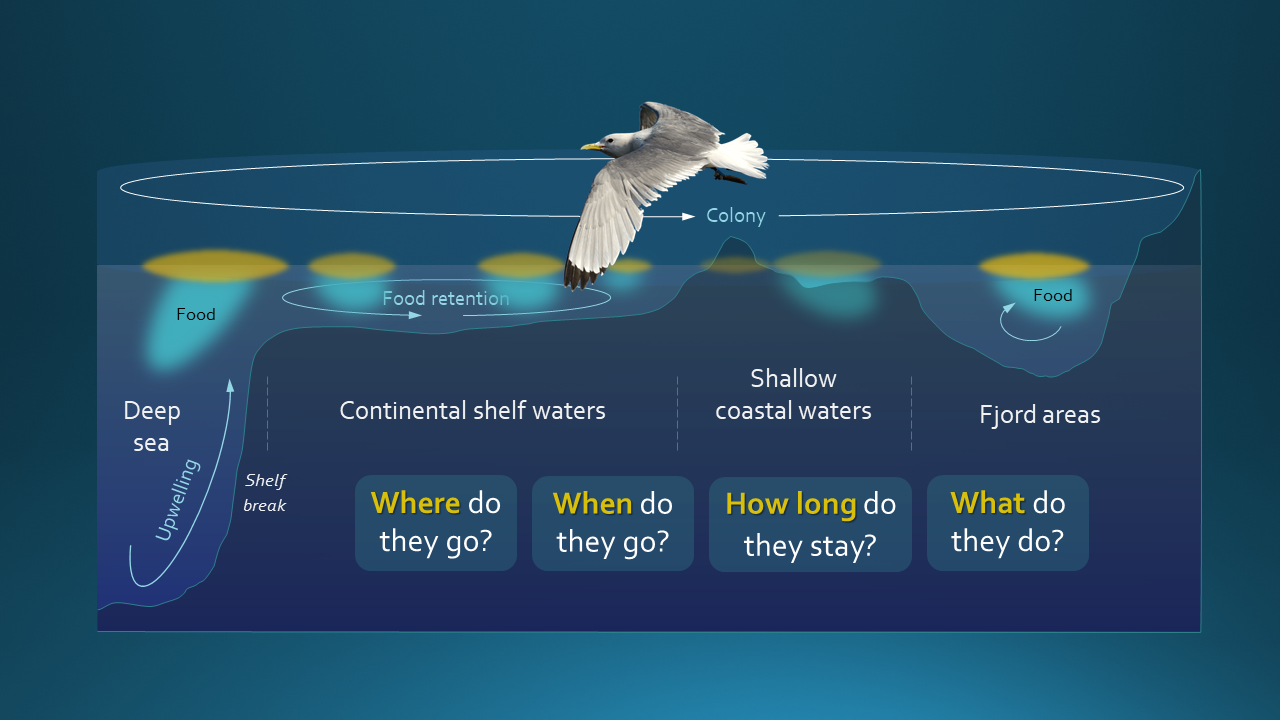
Illustration © Tycho Anker-Nilssen
Contact person: Signe Christensen-Dalsgaard, NINA