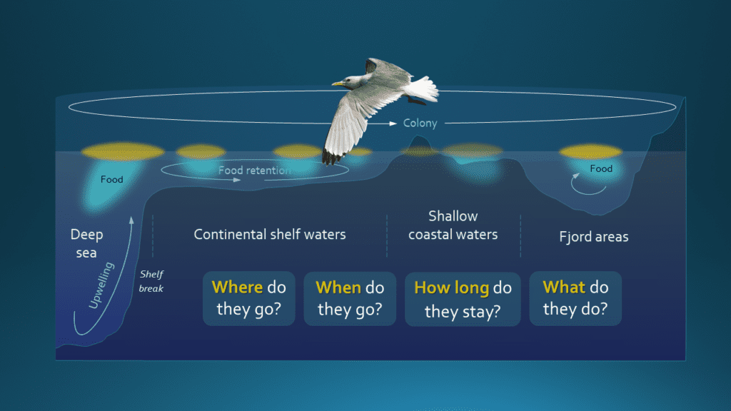
Habitat use during the breeding season
Tracking the fine-scale movements of breeding seabirds with GPS loggers provides unique insight into how seabirds use the marine areas surrounding the colonies. In SEAPOP, the first study using GPS logging of seabirds was initiated in 2010, and by 2021 the tracking work includes 8 different species and 15 different colonies, spread from Rogaland to Spitsbergen. In SEAPOP, fine-scale GPS logging has so far only been conducted during the breeding season.
Aims and applications
The data from the GPS logging of breeding birds enables us to map in detail which areas are the most important for key activities when the birds are away from the nest, such as foraging, resting and preening. It also allows us to calculate the birds’ time budgets and energy expenditure. A principal aim is to explore the spatial dynamics of their movements both within and between seasons, and how this can explain key parameters such as diets, chick growth and breeding success. By comparing similar information across different sites and species, we will be able to explain in more general terms which environmental factors are key drivers of the distribution of seabirds around the colonies and how they affect their productivity. GPS logging thus not only delivers very important knowledge for a wide range of management issues, but also helps to build a more fundamental ecological understanding of how seabirds exploit the areas around the colonies, and how this varies over time. This adds some much needed pieces to the big puzzle of explaining what are the main threats to the seabirds in Norwegian waters.
Techniques
SEAPOP uses a wide range of GPS loggers, with the choice of model depending on study species, research questions and colony accessibility. GPS loggers are fastened to the tail or back of the birds using tape, cable ties and/or glue, and are removed (or lost) after a given period of time, usually within a few days or weeks.

Photo © Signe Christensen-Dalsgaard
Selected species and sites
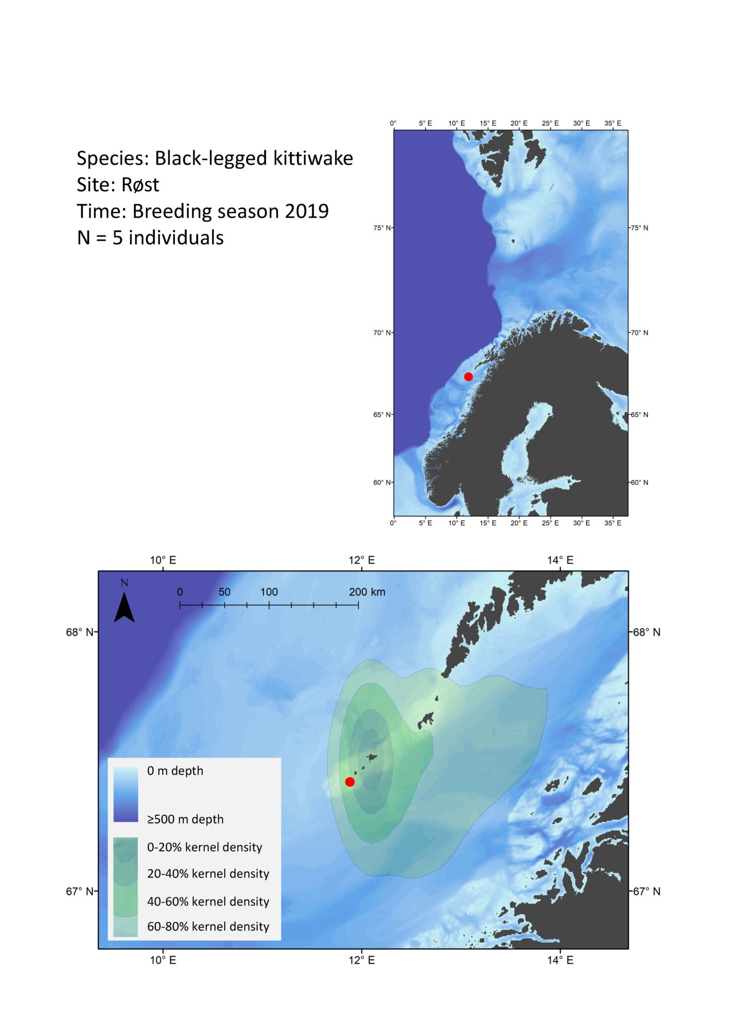
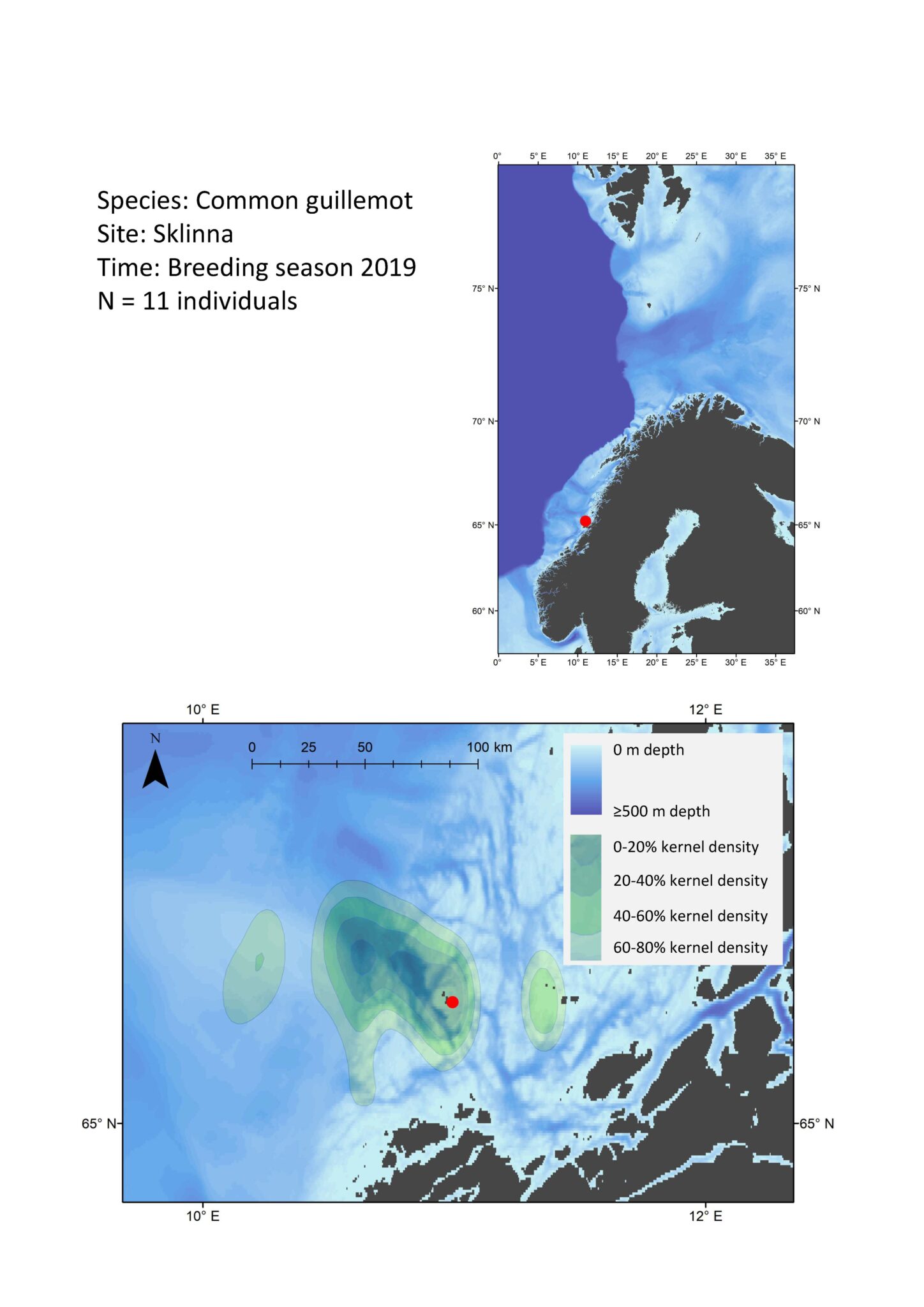
The table below lists the number of years we have tracked different species using GPS loggers at different locations. The localities are described in links, and we present example maps for a few species/localities showing kernel densities of the species around the breeding site (click on the species name to see the map).